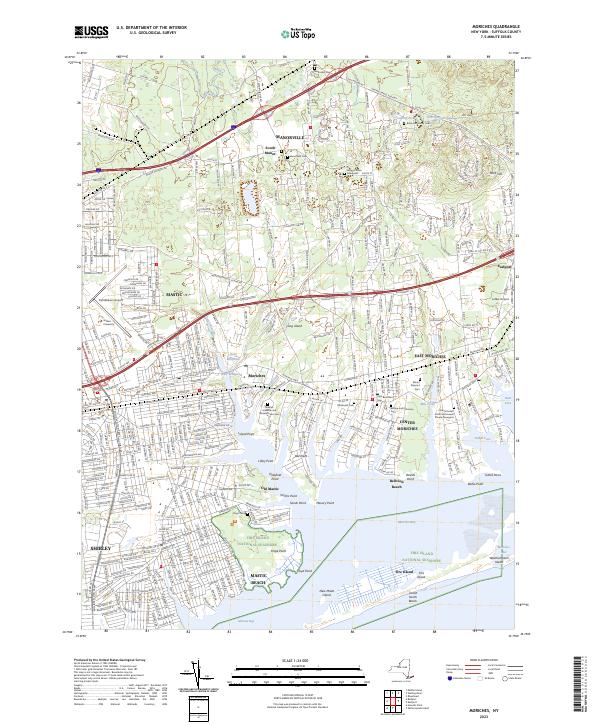
2023 Map of Moriches
USGS Topo · Published 2023About this map
Fire Island National Seashore and the Wertheim National Wildlife Refuge dominate the coastal landscape of southern Suffolk County, where the Forge River meets the protected waters of Moriches Bay. This survey captures the intricate interface between the Atlantic barrier islands and the mainland settlements of Mastic Beach, Center Moriches, and East Moriches. Genealogists will find significant value in the documentation of several family burial sites, including the Robinson Family Cem and the Colonel Josiah Smith and Howell Private Graveyard. The infrastructure of the area is defined by the Long Island railroad corridor and major thoroughfares like Sunrise Hwy and Montauk Hwy. Notable landmarks such as Brookhaven Airport and Naderi University anchor the inland development, while the dynamic Moriches Inlet marks the ever-shifting connection to the open sea.
Find a feature on this map
78 named features on this map. Tap any name to fly to it.
Don’t see what you’re looking for? This feature index may not catch every label — zoom into the map to look around manually.
Map Details
Editions of this 2023 Moriches Map
This is the sole edition of this map. No revisions or reprints were ever made.
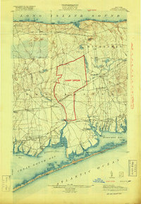
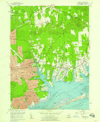
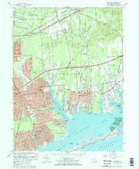
Historical Maps of Moriches Through Time
4 maps found