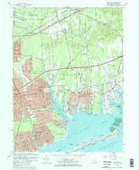
1967 Map of Moriches
USGS Topo · Published 1970About this map
The U S Reservation Brookhaven National Laboratory dominates the northern landscape, where the Peconic River originates amidst a network of firebreaks. This mid-century survey captures the rapid suburban development of the South Shore, particularly in Shirley, Mastic, and Center Moriches. The map illustrates a transition from the agricultural past, represented by scattered sandpits and the Brookfield Gym, to a more modern infrastructure including the Long Island Expressway and the New York National Speedway.
Find a feature on this map
78 named features on this map. Tap any name to fly to it.
Don’t see what you’re looking for? This feature index may not catch every label — zoom into the map to look around manually.
Map Details
Editions of this 1967 Moriches Map
2 editions found
Other maps of this area

1903 · Riverhead
USGS Topo · 1:62,500

1904 · Riverhead
USGS Topo · 1:62,500

1904 · Moriches
USGS Topo · 1:62,500

1943 · Riverhead
USGS Topo · 1:62,500

1947 · Bellport
USGS Topo · 1:24,000

1947 · Howells Point
USGS Topo · 1:24,000

1947 · Riverhead
USGS Topo · 1:24,000

1947 · Eastport
USGS Topo · 1:24,000
1947 · Middle Island
USGS Topo · 1:24,000

1949 · New York
USGS Topo · 1:250,000