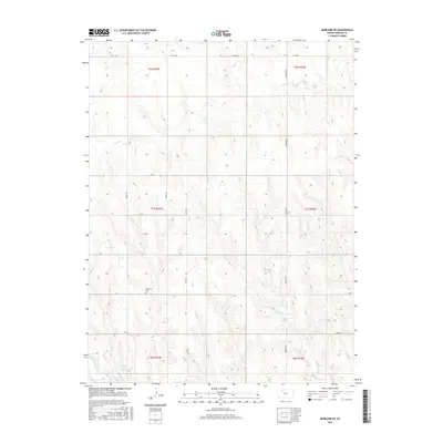
2015 Map of Morland NE
USGS Topo · Published 2015About this map
Antelope Lake and the surrounding drainage basins of Graham County define this prairie landscape as it was documented in 2015. The terrain is characterized by the winding paths of Bow Cr and Rock Cr, which carve through the high plains topography north of the lake. For those tracing family histories or early settlement patterns, the Anderson Cem is a prominent genealogical landmark situated between W Rd and V Rd. The map illustrates the rigid township and range system that organized this part of Kansas, visible through the grid of section lines and gravel connectors like Goddard Rd and Co Rd 523. This 2015 survey shows the modern rural infrastructure, where local routes like Creek S and T Rd link isolated agricultural tracts and preserve the geographic orientation of the county's northern reaches.
Find a feature on this map
22 named features on this map. Tap any name to fly to it.
Don’t see what you’re looking for? This feature index may not catch every label — zoom into the map to look around manually.
Map Details
Editions of this 2015 Morland NE Map
This is the sole edition of this map. No revisions or reprints were ever made.
Other maps of this area

1893 · Norton
USGS Topo · 1:125,000

1893 · Hill
USGS Topo · 1:125,000

1954 · Goodland
USGS Topo · 1:250,000

1955 · Beloit
USGS Topo · 1:250,000

1956 · Goodland
USGS Topo · 1:250,000

1957 · Goodland
USGS Topo · 1:250,000

1959 · Beloit
USGS Topo · 1:250,000

1978 · Clayton SW
USGS Topo · 1:24,000

1978 · Lenora East
USGS Topo · 1:24,000

1978 · Lenora West
USGS Topo · 1:24,000