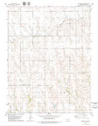
1979 Map of Morland NE
USGS Topo · Published 1979About this map
Bow Creek and Rock Creek wind through the high plains of Graham County in this late-1970s survey, illustrating the rural character of the Indiana and Gettysburg townships. The landscape is defined by its agricultural and industrial utility, featuring scattered Wells and a dedicated Oil Field in the southern portion of the quadrangle. For those researching local family history, the Anderson Cem is a prominent landmark situated near a Ford crossing. The map preserves the transition of the terrain near Antelope Cr, where the section lines of Allodium township reveal a structured pattern of land use typical of the Kansas prairie during this era of petroleum exploration.
Find a feature on this map
13 named features on this map. Tap any name to fly to it.
Don’t see what you’re looking for? This feature index may not catch every label — zoom into the map to look around manually.
Map Details
Editions of this 1979 Morland NE Map
This is the sole edition of this map. No revisions or reprints were ever made.
Other maps of this area

1893 · Norton
USGS Topo · 1:125,000

1893 · Hill
USGS Topo · 1:125,000

1954 · Goodland
USGS Topo · 1:250,000

1955 · Beloit
USGS Topo · 1:250,000

1956 · Goodland
USGS Topo · 1:250,000

1957 · Goodland
USGS Topo · 1:250,000

1959 · Beloit
USGS Topo · 1:250,000

1978 · Clayton SW
USGS Topo · 1:24,000

1978 · Lenora East
USGS Topo · 1:24,000

1978 · Lenora West
USGS Topo · 1:24,000