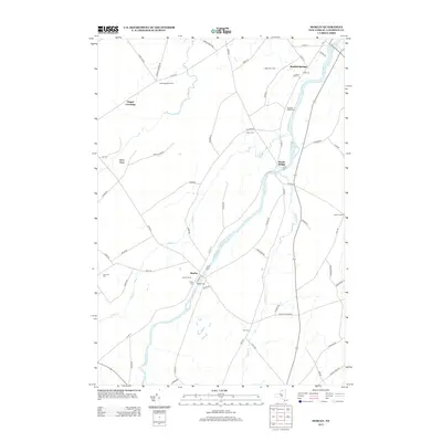
2013 Map of Morley
USGS Topo · Published 2013About this map
The Grass River flows through a landscape defined by small river settlements and longstanding agricultural holdings in this Saint Lawrence County survey. The hamlet of Morley serves as a local focal point, surrounded by family-named operations such as Jordan Farms and Paradise Valley Farm. Further north, the river passes through Bucks Bridge and nears the community of Madrid Springs, where Depot ST and Spring ST suggest the historical importance of the rail and water resources to the local economy.
Find a feature on this map
62 named features on this map. Tap any name to fly to it.
Don’t see what you’re looking for? This feature index may not catch every label — zoom into the map to look around manually.
Map Details
Editions of this 2013 Morley Map
This is the sole edition of this map. No revisions or reprints were ever made.
Other maps of this area

1904 · Lisbon
USGS Topo · 1:48,000

1904 · Ogdensburg
USGS Topo · 1:62,500

1905 · Waddington
USGS Topo · 1:62,500

1905 · Ogdensburg
USGS Topo · 1:62,500

1906 · Red Mills
USGS Topo · 1:62,500

1910 · Canton
USGS Topo · 1:62,500

1911 · Canton
USGS Topo · 1:62,500

1942 · Waddington
USGS Topo · 1:24,000

1942 · Chase Mills
USGS Topo · 1:24,000

1943 · Rensselaer Falls
USGS Topo · 1:31,680