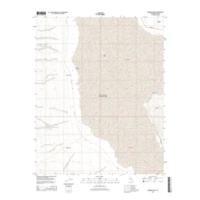
2015 Map of Mormon Point
USGS Topo · Published 2015About this map
Mormon Point overlooks the floor of Death Valley in this modern topographic study of the Mojave Desert. The landscape is defined by the stark transition from the alluvial fans and salt flats to the rising terrain of the Amargosa Range at the eastern edge. This portion of Death Valley National Park highlights the extreme topography of the region, where critical desert corridors like Badwater Rd and W Side Rd navigate the lowlands between mountain slopes. The map traces the intricate drainage patterns that spill from the highlands toward the valley floor, illustrating the geological processes that continue to shape this iconic desert environment.
Find a feature on this map
11 named features on this map. Tap any name to fly to it.
Don’t see what you’re looking for? This feature index may not catch every label — zoom into the map to look around manually.
Map Details
Editions of this 2015 Mormon Point Map
This is the sole edition of this map. No revisions or reprints were ever made.
Other maps of this area

1908 · Furnace Creek
USGS Topo · 1:250,000

1910 · Furnace Creek
USGS Topo · 1:250,000

1933 · Avawatz Mountains
USGS Topo · 1:250,000

1947 · Trona
USGS Topo · 1:250,000

1948 · Trona
USGS Topo · 1:250,000

1948 · Death Valley
USGS Topo · 1:250,000

1950 · Wingate Wash
USGS Topo · 1:62,500

1950 · Confidence Hills
USGS Topo · 1:62,500

1951 · Funeral Peak
USGS Topo · 1:62,500

1952 · Bennetts Well
USGS Topo · 1:62,500