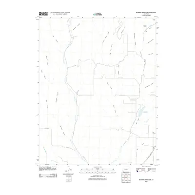
2010 Map of Mormon Reservoir
USGS Topo · Published 2010About this map
Mormon Reservoir and the La Plata River corridor anchor this Southwest Colorado landscape, where early 21st-century irrigation remains vital to the local economy. The network of water management is visible through the Hay Gulch Irrigation Ditch and Big Stick Ditch, which support the agricultural life of the Red Mesa area. Genealogy and local history are preserved at the Hay Gulch Cemetery and Kline Cemetery, marking the generations of families who settled the land between these canyons. The terrain is deeply incised by a series of drainages, including Cherry Creek and the many-branched Alkali Gulch. Evidence of the region's extraction history is found in the northern reaches at the Tepoch Mine, while newer residential developments like Crystal Acres show the shifting land use near the reservoir.
Find a feature on this map
45 named features on this map. Tap any name to fly to it.
Don’t see what you’re looking for? This feature index may not catch every label — zoom into the map to look around manually.
Map Details
Editions of this 2010 Mormon Reservoir Map
This is the sole edition of this map. No revisions or reprints were ever made.
Other maps of this area

1895 · La Plata
USGS Topo · 1:62,500

1897 · La Plata
USGS Topo · 1:62,500

1899 · La Plata
USGS Topo · 1:62,500

1908 · La Plata
USGS Topo · 1:62,500

1912 · Soda Canyon
USGS Topo · 1:62,500

1913 · Red Mesa
USGS Topo · 1:62,500

1915 · Soda Canyon
USGS Topo · 1:62,500

1956 · Cortez
USGS Topo · 1:250,000

1958 · Cortez
USGS Topo · 1:250,000

1959 · Cortez
USGS Topo · 1:250,000