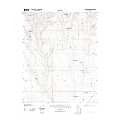
2013 Map of Mormon Reservoir
USGS Topo · Published 2013About this map
Red Mesa and the residential pocket of Crystal Acres anchor the southeastern corner of this southwestern Colorado landscape. The terrain is defined by a dense network of drainages and named canyons, including Wildwater Canyon, Bear Canyon, and Schoolhouse Canyon, which descend toward the La Plata River and Cherry Creek. Agricultural and water management infrastructure is evident through the Mormon Reservoir and Red Mesa Ward Reservoir, essential features for life in this arid canyon country. For genealogists and local historians, the presence of the Hay Gulch Cemetery and Kline Cemetery provides specific points of interest for family research. The map also traces various local routes such as Alkali Gulch Road and County Road 117, illustrating the rural connectivity between these high-mesa settlements and the surrounding gulches.
Find a feature on this map
49 named features on this map. Tap any name to fly to it.
Don’t see what you’re looking for? This feature index may not catch every label — zoom into the map to look around manually.
Map Details
Editions of this 2013 Mormon Reservoir Map
This is the sole edition of this map. No revisions or reprints were ever made.
Other maps of this area

1895 · La Plata
USGS Topo · 1:62,500

1897 · La Plata
USGS Topo · 1:62,500

1899 · La Plata
USGS Topo · 1:62,500

1908 · La Plata
USGS Topo · 1:62,500

1912 · Soda Canyon
USGS Topo · 1:62,500

1913 · Red Mesa
USGS Topo · 1:62,500

1915 · Soda Canyon
USGS Topo · 1:62,500

1956 · Cortez
USGS Topo · 1:250,000

1958 · Cortez
USGS Topo · 1:250,000

1959 · Cortez
USGS Topo · 1:250,000