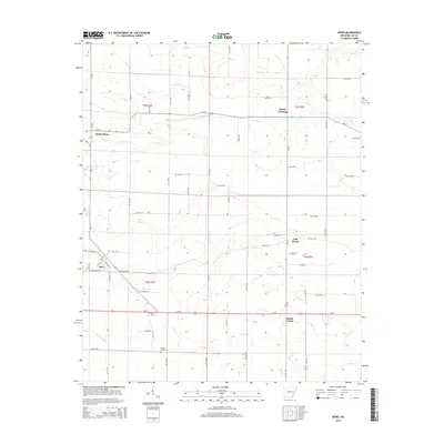
2014 Map of Moro
USGS Topo · Published 2014About this map
The town of Moro serves as the primary hub of this eastern Arkansas landscape, situated at the junction of several key local routes and Highway 78. This agricultural region in Lee County is characterized by a dense network of country roads, including Lee 432 Rd and Lee 410 Rd, which connect small outlying settlements and historic crossroads. Notable community nodes include Oak Forest and South Plains, reflecting the rural settlement patterns that have defined the area for generations.
Find a feature on this map
61 named features on this map. Tap any name to fly to it.
Don’t see what you’re looking for? This feature index may not catch every label — zoom into the map to look around manually.
Map Details
Editions of this 2014 Moro Map
This is the sole edition of this map. No revisions or reprints were ever made.
Other maps of this area

1940 · Marvell
USGS Topo · 1:62,500

1940 · Holly Grove
USGS Topo · 1:62,500

1940 · Brinkley
USGS Topo · 1:62,500

1940 · Marianna
USGS Topo · 1:62,500

1948 · Helena
USGS Topo · 1:250,000

1950 · Helena
USGS Topo · 1:250,000

1955 · Helena
USGS Topo · 1:250,000

1956 · Marvell
USGS Topo · 1:62,500
1957 · Marianna
USGS Topo · 1:62,500

1957 · Holly Grove
USGS Topo · 1:62,500