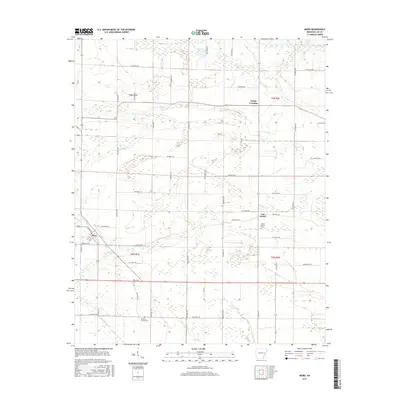
2017 Map of Moro
USGS Topo · Published 2017About this map
Moro serves as the primary settlement on this Lee County landscape, situated at a junction where local roads meet the primary thoroughfares. The terrain is defined by a dense network of watercourses, including the winding Larkin Cr in the north and the descriptively named Little Hog Tusk Cr in the southwest. This area preserves several traditional burial grounds essential for genealogical research, such as Mount Moriah Cem near Oak Forest and Hawkins Chapel Cem further south. The map illustrates a strictly organized section-and-range system, with rural communities like Holub Crossing emerging at the intersection of various Lee Road routes. These roads, from Lee Road 815 to Lee Road 410, reveal the continued reliance on a grid-based transportation network that facilitates movement through the low-lying creek bottoms and agricultural fields of eastern Arkansas.
Find a feature on this map
57 named features on this map. Tap any name to fly to it.
Don’t see what you’re looking for? This feature index may not catch every label — zoom into the map to look around manually.
Map Details
Editions of this 2017 Moro Map
This is the sole edition of this map. No revisions or reprints were ever made.
Other maps of this area

1940 · Marvell
USGS Topo · 1:62,500

1940 · Holly Grove
USGS Topo · 1:62,500

1940 · Brinkley
USGS Topo · 1:62,500

1940 · Marianna
USGS Topo · 1:62,500

1948 · Helena
USGS Topo · 1:250,000

1950 · Helena
USGS Topo · 1:250,000

1955 · Helena
USGS Topo · 1:250,000

1956 · Marvell
USGS Topo · 1:62,500
1957 · Marianna
USGS Topo · 1:62,500

1957 · Holly Grove
USGS Topo · 1:62,500