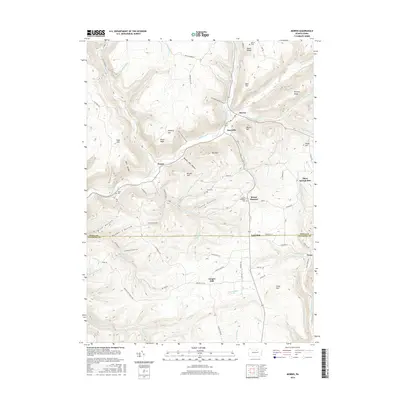
2016 Map of Morris
USGS Topo · Published 2016About this map
Babb Cr flows through a landscape defined by deep hollows and high ridges at the border of Tioga and Lycoming counties. The village of Morris serves as a central point for the surrounding hamlets of Hoytville, Lorenton, and Doane. This 2016 survey illustrates a region where local geography is marked by historic burial sites like Antrim Cem and Lewis Cem, reflecting generations of settlement in the Pennsylvania hills. To the south, Oregon Hill sits near the headwaters of Hughes Run and Bonnell Run. The terrain is etched with dozens of named drainages including Black Run, Three Springs Run, and Trout Run, which cut between landmarks such as Texas Mtn, The Horn, and Bald Hill. Small road systems like English Settlement Rd and Rattler Mine Rd suggest the area's long-standing connection to local industries and family homesteads.
Find a feature on this map
76 named features on this map. Tap any name to fly to it.
Don’t see what you’re looking for? This feature index may not catch every label — zoom into the map to look around manually.
Map Details
Editions of this 2016 Morris Map
This is the sole edition of this map. No revisions or reprints were ever made.
Other maps of this area

1921 · Trout Run
USGS Topo · 1:62,500

1923 · Trout Run
USGS Topo · 1:62,500

1925 · Blossburg
USGS Topo · 1:62,500

1927 · Blossburg
USGS Topo · 1:62,500

1937 · Waterville
USGS Topo · 1:48,000

1943 · Waterville
USGS Topo · 1:62,500

1944 · Blossburg
USGS Topo · 1:62,500

1944 · Trout Run
USGS Topo · 1:62,500

1946 · Tiadaghton
USGS Topo · 1:24,000

1946 · Antrim
USGS Topo · 1:62,500
Featured Places
- Morris Township, PA
- Duncan Township, PA
- Pine Township, PA
- Lorenton, Morris Township
- Three Springs Run, Morris Township