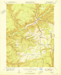
1950 Map of Morris
USGS Topo · Published 1950About this map
Babb Creek winds through a landscape of deep hollows and high ridges at the boundary of Tioga and Lycoming Counties. The settlement at Morris serves as a focal point where Wilson Creek and Babb Creek converge, supported by the Erie RR corridor that tracks the water’s edge. Industrial history is visible in names like Tannery Hill Run and an upland mine near Rattler Hill, suggesting the timber and extraction activities that once defined this region.
Find a feature on this map
64 named features on this map. Tap any name to fly to it.
Don’t see what you’re looking for? This feature index may not catch every label — zoom into the map to look around manually.
Map Details
Editions of this 1950 Morris Map
This is the sole edition of this map. No revisions or reprints were ever made.
Other maps of this area

1921 · Trout Run
USGS Topo · 1:62,500

1923 · Trout Run
USGS Topo · 1:62,500

1925 · Blossburg
USGS Topo · 1:62,500

1927 · Blossburg
USGS Topo · 1:62,500

1937 · Waterville
USGS Topo · 1:48,000

1943 · Waterville
USGS Topo · 1:62,500

1944 · Blossburg
USGS Topo · 1:62,500

1944 · Trout Run
USGS Topo · 1:62,500

1946 · Tiadaghton
USGS Topo · 1:24,000

1946 · Antrim
USGS Topo · 1:62,500
Featured Places
- Morris Township, PA
- Duncan Township, PA
- Brown Township, PA
- Pine Township, PA
- Mount Pleasant, Morris Township