2022 Map of Morrison
USGS Topo · Published 2022About this map
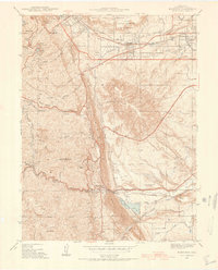
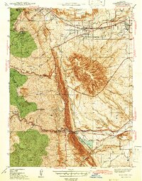
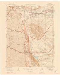
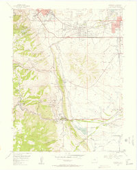
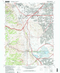
The dramatic transition from the Colorado foothills to the western Denver suburbs is captured here, centered on the geological prominence of Dinosaur Ridge and the Hogback. The landscape is dominated by steep terrain such as Lookout Mtn and Mt Morrison, overlooking the developed corridors of Golden and Lakewood. Significant cultural landmarks include the William F Cody Grave on the heights above Golden and the Red Rocks Community College Lakewood Campus. This area serves as a critical hydrological junction, where Bear Creek flows through Bear Creek Canyon into the Bear Creek Lake reservoir system. The map also details the extensive trail network connecting residential areas like Green Mountain Village to open spaces, including the Summit Loop Trl and Village Walk Trl.
Find a feature on this map
102 named features on this map. Tap any name to fly to it.
Don’t see what you’re looking for? This feature index may not catch every label — zoom into the map to look around manually.
Map Details
Editions of this 2022 Morrison Map
This is the sole edition of this map. No revisions or reprints were ever made.
Historical Maps of Idledale Through Time
6 maps found