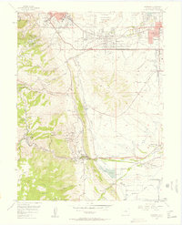
1957 Map of Morrison
USGS Topo · Published 1958About this map
Red Rocks Park dominates the central landscape of this late-1950s survey, showcasing the iconic Red Rocks Amphitheater and massive geological formations like Ship Rock and Creation Rock. The map details the transition from the growing urban edge of Golden to the foothills of the Front Range. Institutional presence is heavy near the northern border, where the State Industrial School for Boys and Camp George West occupy large tracts of land.
Find a feature on this map
67 named features on this map. Tap any name to fly to it.
Don’t see what you’re looking for? This feature index may not catch every label — zoom into the map to look around manually.
Map Details
Editions of this 1957 Morrison Map
This is the sole edition of this map. No revisions or reprints were ever made.
Other maps of this area

1899 · West Denver
USGS Topo · 1:125,000

1906 · Blackhawk
USGS Topo · 1:62,500

1938 · Morrison
USGS Topo · 1:24,000

1939 · Golden
USGS Topo · 1:24,000

1941 · Arvada
USGS Topo · 1:31,680

1941 · Fort Logan
USGS Topo · 1:31,680

1942 · Morrison
USGS Topo · 1:31,680

1942 · Golden
USGS Topo · 1:31,680

1942 · Littleton
USGS Topo · 1:31,680

1942 · Ralston Buttes
USGS Topo · 1:24,000