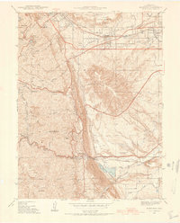
1938 Map of Morrison
USGS Topo · Published 1938About this map
Golden and Morrison anchor this 1938 survey of the Colorado Front Range, revealing a landscape defined by dramatic geology and early infrastructure. The terrain transitions sharply from the heights of Lookout Mountain and Mount Morrison down to the plains, intersected by the prominent Hogback ridge. Water management is a primary focus of the era, seen in the intricate network of the Agricultural Ditch, Rocky Mountain Ditch, and Ward Canal serving the foothills.
Find a feature on this map
53 named features on this map. Tap any name to fly to it.
Don’t see what you’re looking for? This feature index may not catch every label — zoom into the map to look around manually.
Map Details
Editions of this 1938 Morrison Map
2 editions found
Other maps of this area

1899 · West Denver
USGS Topo · 1:125,000

1906 · Blackhawk
USGS Topo · 1:62,500

1938 · Morrison
USGS Topo · 1:24,000

1939 · Golden
USGS Topo · 1:24,000

1941 · Arvada
USGS Topo · 1:31,680

1941 · Fort Logan
USGS Topo · 1:31,680

1942 · Morrison
USGS Topo · 1:31,680

1942 · Golden
USGS Topo · 1:31,680

1942 · Littleton
USGS Topo · 1:31,680

1942 · Ralston Buttes
USGS Topo · 1:24,000