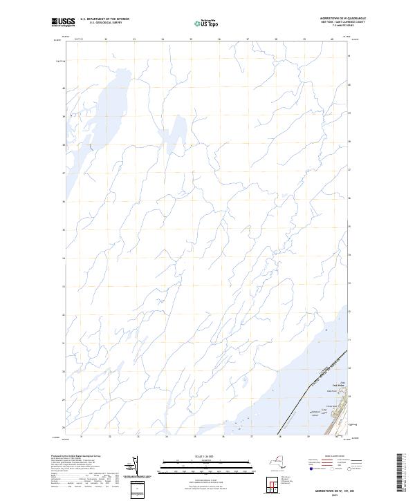
2023 Map of Morristown OE W
USGS Topo · Published 2023About this map
The Saint Lawrence River serves as the focal point of this coastal landscape, marking the international boundary between the United States and Canada. Concentrated in the southeastern corner of the quadrangle, the small settlements of Oak Point and Zitka represent the primary residential clusters along the water's edge. This modern survey illustrates the current layout of local access routes like River Rd and Riverledge Rd, which trace the shoreline and connect the inland terrain to the riverfront.
Find a feature on this map
9 named features on this map. Tap any name to fly to it.
Don’t see what you’re looking for? This feature index may not catch every label — zoom into the map to look around manually.
Map Details
Editions of this 2023 Morristown OE W Map
This is the sole edition of this map. No revisions or reprints were ever made.
Other maps of this area

1903 · Alexandria Bay
USGS Topo · 1:62,500

1906 · Brier Hill
USGS Topo · 1:62,500

1912 · Hammond
USGS Topo · 1:62,500

1942 · Morristown
USGS Topo · 1:24,000

1943 · Morristown
USGS Topo · 1:31,680

1944 · Hammond
USGS Topo · 1:62,500

1948 · Chippewa Bay
USGS Topo · 1:24,000

1948 · Alexandria Bay
USGS Topo · 1:62,500

1948 · Ogdensburg
USGS Topo · 1:250,000

1949 · Hammond
USGS Topo · 1:62,500