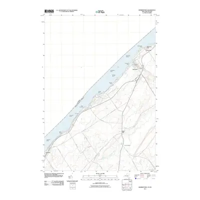
2011 Map of Morristown
USGS Topo · Published 2011About this map
The Saint Lawrence River defines this riverfront landscape, serving as the international boundary between Morristown and Ontario, Canada. Along the New York shore, the village of Morristown is clustered around Morristown Bay, where local history is preserved at Sunnyside Cemetery, Pine Hill Cemetery, and Greenwood Cemetery. The inland terrain transitions toward the agricultural and marshy reaches of Chippewa Creek and the northern tip of Black Lake. Moving southwest, smaller settlements and shoreline features like Oak Point and Point Comfort appear alongside Halls Dock. The map details a network of rural routes such as Oak Point Rd and Old Mills Rd, which connect the riverfront to the community of Brier Hill. This survey highlights the balance between the heavy river commerce suggested by Oak Point Shoal and the quiet inland rail-connected history of Brier Hill Station.
Find a feature on this map
48 named features on this map. Tap any name to fly to it.
Don’t see what you’re looking for? This feature index may not catch every label — zoom into the map to look around manually.
Map Details
Editions of this 2011 Morristown Map
This is the sole edition of this map. No revisions or reprints were ever made.
Other maps of this area

1903 · Alexandria Bay
USGS Topo · 1:62,500

1906 · Brier Hill
USGS Topo · 1:62,500

1912 · Hammond
USGS Topo · 1:62,500

1942 · Morristown
USGS Topo · 1:24,000

1943 · Morristown
USGS Topo · 1:31,680

1943 · Edwardsville
USGS Topo · 1:31,680
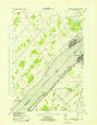
1943 · Ogdensburg West
USGS Topo · 1:31,680

1944 · Hammond
USGS Topo · 1:62,500

1948 · Chippewa Bay
USGS Topo · 1:24,000

1948 · Alexandria Bay
USGS Topo · 1:62,500