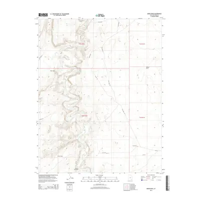
2014 Map of Moses Rock
USGS Topo · Published 2014About this map
Chinle Creek defines the lower drainage of this corner of the Shiprock Agency region, winding through a complex landscape of mesas and canyons. The terrain is marked by distinctive geological formations such as the namesake Moses Rock and the prominent Garnet Ridge to the south. Local heritage and family-named sites are visible through labels like Steve Pehrson and Hosteen Tso Canyon, while Poncho House indicates significant cultural sites within the Nokaito Bench area. The 2014 survey records a network of unpaved routes, including Chinle Creek Rd, Comb Ridge Rd, and Pelt Rd, which provide access through the desert floor and over the high-elevation breaks. These tracks and local landmarks reflect the continued importance of land-based navigation in this part of the San Juan County high desert.
Find a feature on this map
18 named features on this map. Tap any name to fly to it.
Don’t see what you’re looking for? This feature index may not catch every label — zoom into the map to look around manually.
Map Details
Editions of this 2014 Moses Rock Map
This is the sole edition of this map. No revisions or reprints were ever made.
Other maps of this area

1886 · Abajo
USGS Topo · 1:250,000

1892 · Abajo
USGS Topo · 1:250,000

1892 · Canyon De Chelly
USGS Topo · 1:250,000

1893 · Abajo
USGS Topo · 1:250,000

1952 · Bluff 3 SE
USGS Topo · 1:24,000

1952 · Dinnehotso
USGS Topo · 1:62,500

1952 · Setsiltso Springs 2 NE
USGS Topo · 1:24,000

1954 · Shiprock
USGS Topo · 1:250,000

1956 · Cortez
USGS Topo · 1:250,000

1958 · Cortez
USGS Topo · 1:250,000