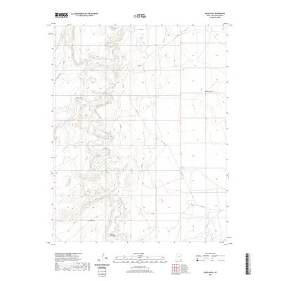
2020 Map of Moses Rock
USGS Topo · Published 2020About this map
Chinle Creek meanders through the heart of this landscape, carving a winding path through the high desert of the Shiprock Agency region. The terrain is defined by prominent geographical landmarks like Moses Rock and the extensive Nokaito Bench, reflecting the stark geologic character of San Juan County. For researchers and historians, the presence of Hosteen Tso Canyon and Garnet Ridge offers specific points of interest within the broader network of county and bureau roads. Local transit is facilitated by a grid of routes such as RD 4021 and the uniquely named C R 491 - Poncho House, which points toward regional archaeological significance. This 2020 survey documents the contemporary state of the land, detailing the intersections of natural drainage systems and modern access roads.
Find a feature on this map
14 named features on this map. Tap any name to fly to it.
Don’t see what you’re looking for? This feature index may not catch every label — zoom into the map to look around manually.
Map Details
Editions of this 2020 Moses Rock Map
This is the sole edition of this map. No revisions or reprints were ever made.
Other maps of this area

1886 · Abajo
USGS Topo · 1:250,000

1892 · Abajo
USGS Topo · 1:250,000

1892 · Canyon De Chelly
USGS Topo · 1:250,000

1893 · Abajo
USGS Topo · 1:250,000

1952 · Bluff 3 SE
USGS Topo · 1:24,000

1952 · Dinnehotso
USGS Topo · 1:62,500

1952 · Setsiltso Springs 2 NE
USGS Topo · 1:24,000

1954 · Shiprock
USGS Topo · 1:250,000

1956 · Cortez
USGS Topo · 1:250,000

1958 · Cortez
USGS Topo · 1:250,000