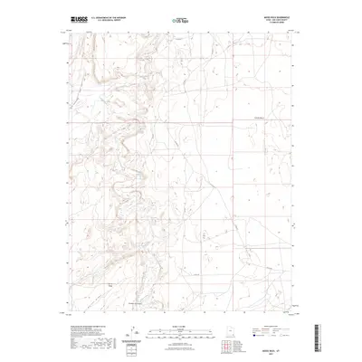
2023 Map of Moses Rock
USGS Topo · Published 2023About this map
Chinle Creek provides the primary drainage through this desert landscape in San Juan County, winding through a complex system of plateaus and canyons. The terrain is defined by the prominent Garnet Ridge in the southwest and the elevated Nokaito Bench to the east. These geological features dictate the path of local travel, including CO RD 491 - Poncho House, which skirts the western hills. The southern reaches of the map include the distinctive Hosteen Tso Canyon, where the topography drops sharply away from the surrounding flats. This 2023 U.S. Geological Survey production illustrates a contemporary look at the sparse road network, featuring routes like Co Rd 449 and Co RD 415 that cross the high desert floor between major landforms.
Find a feature on this map
11 named features on this map. Tap any name to fly to it.
Don’t see what you’re looking for? This feature index may not catch every label — zoom into the map to look around manually.
Map Details
Editions of this 2023 Moses Rock Map
This is the sole edition of this map. No revisions or reprints were ever made.
Other maps of this area

1886 · Abajo
USGS Topo · 1:250,000

1892 · Abajo
USGS Topo · 1:250,000

1892 · Canyon De Chelly
USGS Topo · 1:250,000

1893 · Abajo
USGS Topo · 1:250,000

1952 · Bluff 3 SE
USGS Topo · 1:24,000

1952 · Dinnehotso
USGS Topo · 1:62,500

1952 · Setsiltso Springs 2 NE
USGS Topo · 1:24,000

1954 · Shiprock
USGS Topo · 1:250,000

1956 · Cortez
USGS Topo · 1:250,000

1958 · Cortez
USGS Topo · 1:250,000