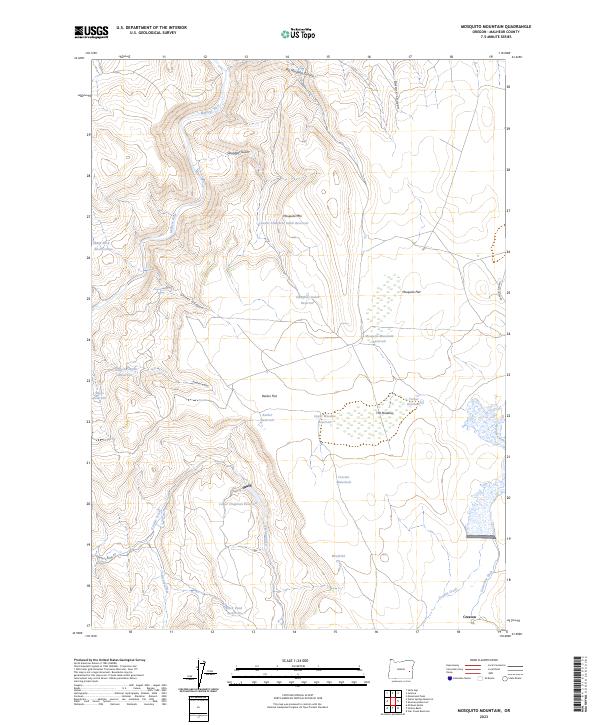
2023 Map of Mosquito Mountain
USGS Topo · Published 2023About this map
The Malheur River flows through the northern reaches of this high desert landscape, carving a path near Slaughter Gulch and Big Mosquito Canyon. This region is defined by an extensive network of water management features, including the Lower Slaughter Gulch Reservoir, Barber Reservoir, and The Meadow Reservoir, which support life in an arid environment. The small settlement of Creston sits in the southeast corner near the Easterday Ditch, serving as a rare point of human habitation among the sagebrush flats and volcanic peaks.
Find a feature on this map
35 named features on this map. Tap any name to fly to it.
Don’t see what you’re looking for? This feature index may not catch every label — zoom into the map to look around manually.
Map Details
Editions of this 2023 Mosquito Mountain Map
This is the sole edition of this map. No revisions or reprints were ever made.
Other maps of this area

1955 · Burns
USGS Topo · 1:250,000

1955 · Boise
USGS Topo · 1:250,000

1958 · Burns
USGS Topo · 1:250,000

1958 · Boise
USGS Topo · 1:250,000

1959 · Burns
USGS Topo · 1:250,000

1962 · Boise
USGS Topo · 1:250,000

1972 · Shumway Reservoir
USGS Topo · 1:24,000
1972 · Star Creek Reservoir
USGS Topo · 1:24,000
1972 · Mc Ewen Butte
USGS Topo · 1:24,000
1972 · Monument Peak
USGS Topo · 1:24,000