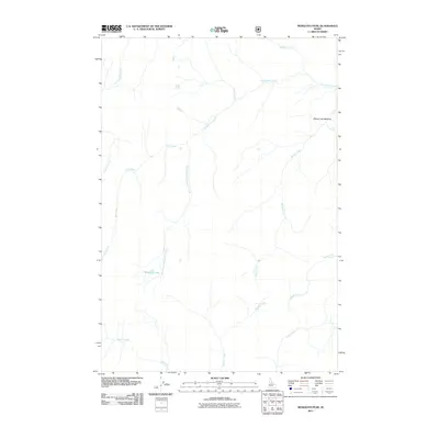
2011 Map of Mosquito Peak
USGS Topo · Published 2011About this map
Chamberlain Creek and its many tributaries, including the South Fork Chamberlain Creek, dominate this high-elevation Idaho landscape. Recorded by the U.S. Geological Survey in 2011, this area represents a dense network of mountain drainage systems and wet meadows rather than human settlement. The presence of Mosquito Lake and the nearby Moose Jaw Meadow suggests a seasonally significant terrain for wildlife and backcountry travel. While roads are virtually absent, the intricate system of named waterways like Moose Creek, Beaver Creek, and Hand Creek indicates a region where terrain is defined entirely by the flow of water through the backcountry. This survey provides a precise account of the wilderness hydrology and topography of central Idaho as it existed in the early 21st century.
Find a feature on this map
13 named features on this map. Tap any name to fly to it.
Don’t see what you’re looking for? This feature index may not catch every label — zoom into the map to look around manually.
Map Details
Editions of this 2011 Mosquito Peak Map
This is the sole edition of this map. No revisions or reprints were ever made.
Other maps of this area

1937 · Big Creek
USGS Topo · 1:48,000

1942 · Big Creek
USGS Topo · 1:62,500

1956 · Elk City
USGS Topo · 1:250,000

1960 · Elk City
USGS Topo · 1:250,000

1969 · Wolf Fang Peak
USGS Topo · 1:24,000

1969 · Big Creek
USGS Topo · 1:24,000

1973 · Bismark Mtn
USGS Topo · 1:24,000

1974 · Meadow Of Doubt
USGS Topo · 1:24,000

1978 · Mosquito Peak
USGS Topo · 1:24,000

1978 · Chicken Peak
USGS Topo · 1:24,000