
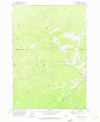
1973 Map of Bismark Mtn
USGS Topo · Published 1975About this map
Payette National Forest dominates this Idaho landscape, where the confluence of high ridges and deep drainage basins defined the movement of early backcountry travelers. The terrain is marked by the prominence of Bismark Mtn and the long stretch of Eightyeight Ridge, which overlooks the winding course of Big Creek. A rare human footprint in this wilderness is found at Copper Camp, a focal point for local mining and prospecting activity. Evidence of early settlement and the hazards of the frontier is preserved in the location of a Grave near Copper Creek. The network of trails, including the Ramey Trail and various pack trails, highlights how surveyors and miners navigated the divide between Idaho and Valley Counties. Key landmarks like Monumental Bridge and Monumental Bar suggest the significance of specific river crossings for those traversing the Monumental Creek corridor.
Find a feature on this map
38 named features on this map. Tap any name to fly to it.
Don’t see what you’re looking for? This feature index may not catch every label — zoom into the map to look around manually.
Map Details
Editions of this 1973 Bismark Mtn Map
2 editions found
Other maps of this area

1937 · Big Creek
USGS Topo · 1:48,000

1942 · Big Creek
USGS Topo · 1:62,500

1956 · Elk City
USGS Topo · 1:250,000

1960 · Elk City
USGS Topo · 1:250,000

1969 · Edwardsburg
USGS Topo · 1:24,000

1969 · Big Creek
USGS Topo · 1:24,000

1973 · Center Mtn
USGS Topo · 1:24,000

1973 · Acorn Butte
USGS Topo · 1:24,000
1973 · Monument
USGS Topo · 1:24,000

1978 · Mosquito Peak
USGS Topo · 1:24,000