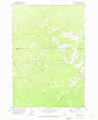
1973 Map of Bismark Mtn
USGS Topo · Published 1975About this map
Payette National Forest dominates this high-altitude landscape along the border of Idaho and Valley counties. The 1970s terrain is defined by a series of steep drainages and prominent divides, notably Eighty-eight Ridge and Ramey Ridge, where surveying crews established markers like Uslm 3212. The presence of Copper Camp and the Monumental Bridge crossing over Monumental Creek suggests the area's legacy of backcountry activity, likely tied to prospecting and forest management. Small-scale mining and exploration are evidenced by Prospect Creek and the named landing at Monumental Bar. Transportation across this challenging environment relied heavily on established trails, including the Pack Tr and various Jeep Trails that connected isolated points like Ramey to the broader river system of Big Creek.
Find a feature on this map
43 named features on this map. Tap any name to fly to it.
Don’t see what you’re looking for? This feature index may not catch every label — zoom into the map to look around manually.
Map Details
Editions of this 1973 Bismark Mtn Map
2 editions found
Other maps of this area

1937 · Big Creek
USGS Topo · 1:48,000

1942 · Big Creek
USGS Topo · 1:62,500

1956 · Elk City
USGS Topo · 1:250,000

1960 · Elk City
USGS Topo · 1:250,000

1969 · Edwardsburg
USGS Topo · 1:24,000

1969 · Big Creek
USGS Topo · 1:24,000

1973 · Center Mtn
USGS Topo · 1:24,000

1973 · Acorn Butte
USGS Topo · 1:24,000

1973 · Bismark Mtn
USGS Topo · 1:24,000
1973 · Monument
USGS Topo · 1:24,000