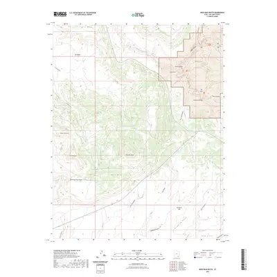
2023 Map of Moss Back Butte
USGS Topo · Published 2023About this map
Kachina Bridge and Owachomo Bridge stand as prominent geological landmarks within this high-desert landscape, where deep incisions like White Canyon and Tuwa Canyon reveal a complex drainage system feeding into White Canyon Creek. The terrain is characterized by massive formations such as The Needle and The Windgate, alongside the eponymous Moss Back Butte. Human passage through this isolated region is marked by primitive routes like Radium King Rd and Guich Creek Rd, as well as specialized paths including the Kachina Trl and Canyon Trl. To the south, the Red House Cliffs and Step Point define the dramatic verticality of the San Juan County topography, while landmarks like The Shoe and Indian Foot provide distinct navigational reference points in an area largely defined by its natural spires and plateaus.
Find a feature on this map
30 named features on this map. Tap any name to fly to it.
Don’t see what you’re looking for? This feature index may not catch every label — zoom into the map to look around manually.
Map Details
Editions of this 2023 Moss Back Butte Map
This is the sole edition of this map. No revisions or reprints were ever made.
Other maps of this area

1886 · Henry Mountains
USGS Topo · 1:250,000

1886 · Abajo
USGS Topo · 1:250,000

1892 · Abajo
USGS Topo · 1:250,000

1892 · Henry Mountains
USGS Topo · 1:250,000

1893 · Abajo
USGS Topo · 1:250,000

1935 · Elk Ridge
USGS Topo · 1:96,000

1940 · Elk Ridge
USGS Topo · 1:125,000

1952 · Natural Bridges
USGS Topo · 1:62,500

1954 · White Canyon 4 NE
USGS Topo · 1:24,000

1954 · White Canyon 4 SE
USGS Topo · 1:24,000