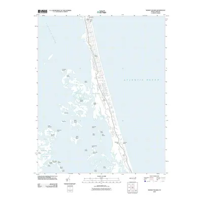
2010 Map of Mossey Islands
USGS Topo · Published 2010About this map
Currituck Light stands as a primary landmark along the narrow coastal strip of the Currituck Banks, where the barrier island separates the Atlantic Ocean from the marshy reaches of Currituck Sound. This coastal landscape is defined by its complex network of islands and marshes, including the Mossey Islands, Brant Island, and Thorofare Island. The map shows a landscape in a period of transition, with established clusters such as Corolla Light Village Shops and Whale Head Hill contrasting with the more isolated reaches of Peters Quarter and Three Dunes.
Find a feature on this map
44 named features on this map. Tap any name to fly to it.
Don’t see what you’re looking for? This feature index may not catch every label — zoom into the map to look around manually.
Map Details
Editions of this 2010 Mossey Islands Map
This is the sole edition of this map. No revisions or reprints were ever made.
Other maps of this area

1940 · Barco
USGS Topo · 1:62,500

1940 · Kitty Hawk
USGS Topo · 1:62,500

1940 · Powells Point
USGS Topo · 1:62,500

1946 · Eastville
USGS Topo · 1:250,000

1946 · Currituck Sound
USGS Topo · 1:250,000

1961 · Eastville
USGS Topo · 1:250,000

1966 · Eastville
USGS Topo · 1:250,000
1982 · Barco
USGS Topo · 1:24,000
1982 · Jarvisburg
USGS Topo · 1:24,000
1982 · Martin Point
USGS Topo · 1:24,000