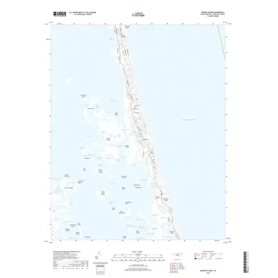
2019 Map of Mossey Islands
USGS Topo · Published 2019About this map
The Outer Banks barrier island system divides the Atlantic from the marshy waters of the Currituck Sound in this coastal survey. Centered on the northern reaches of the peninsula, the map documents the developed corridors of Currituck Beach and Whale Head Hill, where the primary transit route, Ocean Trl, links residential communities along the dunes. The complex shoreline is defined by a labyrinth of islands and tidal channels, including North Burris Island, South Burris Island, and Thorofare Island. The inner coast is dominated by ecological landmarks like Three Dunes and the Tar Cove Marsh, while smaller water bodies like Duck Hole and Old House Pond punctuate the landscape. Private aviation is served by the Pine Island Airport at the southern edge of the quadrangle. This layout emphasizes the narrow, precarious geography of the banks, where human settlement is confined to a thin strip of high ground between the ocean and the expansive wetlands of the sound.
Find a feature on this map
97 named features on this map. Tap any name to fly to it.
Don’t see what you’re looking for? This feature index may not catch every label — zoom into the map to look around manually.
Map Details
Editions of this 2019 Mossey Islands Map
This is the sole edition of this map. No revisions or reprints were ever made.
Other maps of this area

1940 · Barco
USGS Topo · 1:62,500

1940 · Kitty Hawk
USGS Topo · 1:62,500

1940 · Powells Point
USGS Topo · 1:62,500

1946 · Eastville
USGS Topo · 1:250,000

1946 · Currituck Sound
USGS Topo · 1:250,000

1961 · Eastville
USGS Topo · 1:250,000

1966 · Eastville
USGS Topo · 1:250,000
1982 · Barco
USGS Topo · 1:24,000
1982 · Jarvisburg
USGS Topo · 1:24,000
1982 · Martin Point
USGS Topo · 1:24,000