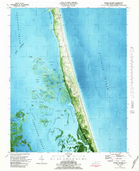
1982 Map of Mossey Islands
USGS Topo · Published 1983About this map
The narrow barrier islands of the Outer Banks are captured here in high detail, showcasing the fragile intersection of maritime forest and migrating sands. Whale Head and Whale Head Hill anchor the northern reaches of this coastal strip, where the terrain transitions from the open beach of Currituck Beach to the intricate marshlands and ponds of Currituck Sound. This 1982 orthophotomap reveals the density of water-fowl habitat, marked by dozens of named ponds like Old House Pond and Canvasback Pond, which speak to the area's long-standing heritage as a destination for sportsmen. Isolated settlements and markers such as Peters Quarter and the Pine Island Club appear alongside topographical features like Poyners Hill and the distinctive Tree Dunes. The map documents a landscape defined by the shifting nature of the coast, where Shifting Sands and tidal flats continuously reshape the boundary between the salt spray of the Atlantic Ocean and the sheltered waters of Sand Cove and Wells Bay.
Find a feature on this map
90 named features on this map. Tap any name to fly to it.
Don’t see what you’re looking for? This feature index may not catch every label — zoom into the map to look around manually.
Map Details
Editions of this 1982 Mossey Islands Map
This is the sole edition of this map. No revisions or reprints were ever made.
Other maps of this area

1940 · Barco
USGS Topo · 1:62,500

1940 · Kitty Hawk
USGS Topo · 1:62,500

1940 · Powells Point
USGS Topo · 1:62,500

1946 · Eastville
USGS Topo · 1:250,000

1946 · Currituck Sound
USGS Topo · 1:250,000

1961 · Eastville
USGS Topo · 1:250,000

1966 · Eastville
USGS Topo · 1:250,000
1982 · Barco
USGS Topo · 1:24,000
1982 · Jarvisburg
USGS Topo · 1:24,000
1982 · Martin Point
USGS Topo · 1:24,000