
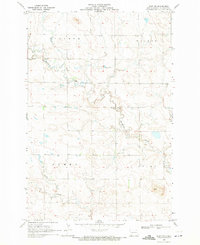
1966 Map of Mott South
USGS Topo · Published 1967About this map
The Mott community stands at the northern edge of this Hettinger County landscape, situated along the winding course of the Cannonball River. This mid-1960s survey reveals a local economy tied to the land and the rails, with both the Northern Pacific and the Chicago Milwaukee St Paul and Pacific lines traversing the valley. The map documents the town's social and recreational infrastructure, from the Fairground and Drive-in Theater to the Wyman Airfield south of the tracks. Moving away from the river valley, the terrain transitions into the high plains of Castle Rock and Brittian. To the south, the topographic detail identifies distinctive landmarks like Gerts Buttes and drainage systems including Mehrer Creek and Timber Creek, providing a clear record of the rural homesteads and township boundaries in Mott, Beery, and Ashby.
Find a feature on this map
19 named features on this map. Tap any name to fly to it.
Don’t see what you’re looking for? This feature index may not catch every label — zoom into the map to look around manually.
Map Details
Editions of this 1966 Mott South Map
This is the sole edition of this map. No revisions or reprints were ever made.
Other maps of this area

1953 · Dickinson
USGS Topo · 1:250,000

1957 · Dickinson
USGS Topo · 1:250,000

1966 · Mott NW
USGS Topo · 1:24,000

1966 · Mott SW
USGS Topo · 1:24,000

1966 · Mott North
USGS Topo · 1:24,000

1969 · Burt
USGS Topo · 1:24,000
1969 · Burt NW
USGS Topo · 1:24,000

1974 · Pearl Butte NW
USGS Topo · 1:24,000

1974 · Long Butte
USGS Topo · 1:24,000

1980 · Mott
USGS Topo · 1:100,000