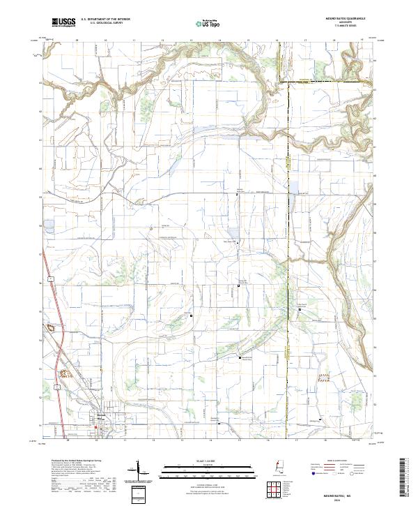
2024 Map of Mound Bayou
USGS Topo · Published 2024About this map
Mound Bayou serves as the focal point of this Mississippi Delta landscape, a region defined by its rich agricultural history and intricate water systems. The terrain is crisscrossed by the Hushpuckena River, Little Mound Bayou, and the Big Sunflower River, which together dictate the drainage patterns for the surrounding fields. The map reveals a dense network of local roads such as Parchman Rd and Old Mound Bayou Rd, reflecting the long-established rural settlement patterns of Bolivar, Sunflower, and Coahoma counties.
Find a feature on this map
80 named features on this map. Tap any name to fly to it.
Don’t see what you’re looking for? This feature index may not catch every label — zoom into the map to look around manually.
Map Details
Editions of this 2024 Mound Bayou Map
This is the sole edition of this map. No revisions or reprints were ever made.
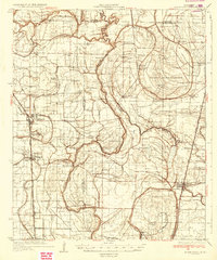
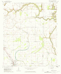
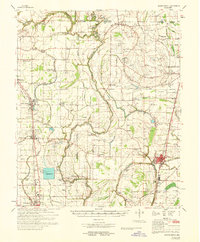
Historical Maps of Mound Bayou Through Time
4 maps found