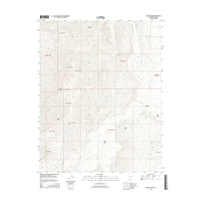
2014 Map of Mount Bangs
USGS Topo · Published 2014About this map
Mount Bangs stands as a prominent high point in this 2014 survey of the Virgin Mountains, where the high-altitude terrain of northwestern Arizona meets the northern reaches of the Mojave Desert. The map reveals a complex system of drainage and seasonal water sources essential to this arid environment, including Gates and Mullen Spring, Sullivans Spring, and Quaking Asp Spring. These water points, along with named features like Last Spring, indicate the vital locations for life in a landscape dominated by deep incisions such as Hedricks Canyon, Figure Four Canyon, and Frehner Canyon. The network of washes, notably Cottonwood Wash and Tom-and-Cull-Wash, illustrates the hydrological patterns that have shaped the land, carving out areas like Pocum Cove and Sullivans Canyon near the massive Black Rock Mtn.
Find a feature on this map
24 named features on this map. Tap any name to fly to it.
Don’t see what you’re looking for? This feature index may not catch every label — zoom into the map to look around manually.
Map Details
Editions of this 2014 Mount Bangs Map
This is the sole edition of this map. No revisions or reprints were ever made.
Other maps of this area

1886 · Mt. Trumbull
USGS Topo · 1:250,000

1892 · Mt. Trumbull
USGS Topo · 1:250,000

1953 · Grand Canyon
USGS Topo · 1:250,000

1954 · Wolf Hole Mtn. NW
USGS Topo · 1:24,000

1954 · Littlefield 3 NE
USGS Topo · 1:24,000

1954 · Littlefield
USGS Topo · 1:62,500

1954 · Cane Springs
USGS Topo · 1:62,500

1957 · Grand Canyon
USGS Topo · 1:250,000

1958 · Grand Canyon
USGS Topo · 1:250,000

1960 · Grand Canyon
USGS Topo · 1:250,000