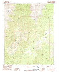
1985 Map of Mount Bangs
USGS Topo · Published 1985About this map
The Virgin Ridge Mountains and Black Rock Mountain dominate this corner of Mohave County, where the landscape is defined by deep drainages like Figure Canyon and Sullivans Canyon. Life in this arid high-country environment was historically sustained by a network of isolated water sources, including Hancock Spr, Atkin Spring, and Gates and Mullen Spr. The presence of Littlefield Reservoir and a Catchment Water Tank underscores the ongoing management of water resources for grazing or local wildlife. Evidence of small-scale extraction is visible at a single Mine located south of the mountains, while the modern era is represented by a Radio Facility perched on a high ridge. The map provides a detailed record of remote landmarks like Pocum Cove and West Fork Gate, essential for navigating this complex terrain of washes and ridges.
Find a feature on this map
26 named features on this map. Tap any name to fly to it.
Don’t see what you’re looking for? This feature index may not catch every label — zoom into the map to look around manually.
Map Details
Editions of this 1985 Mount Bangs Map
This is the sole edition of this map. No revisions or reprints were ever made.
Other maps of this area

1886 · Mt. Trumbull
USGS Topo · 1:250,000

1892 · Mt. Trumbull
USGS Topo · 1:250,000

1953 · Grand Canyon
USGS Topo · 1:250,000

1954 · Wolf Hole Mtn. NW
USGS Topo · 1:24,000

1954 · Littlefield 3 NE
USGS Topo · 1:24,000

1954 · Littlefield
USGS Topo · 1:62,500

1954 · Cane Springs
USGS Topo · 1:62,500

1957 · Grand Canyon
USGS Topo · 1:250,000

1958 · Grand Canyon
USGS Topo · 1:250,000

1960 · Grand Canyon
USGS Topo · 1:250,000