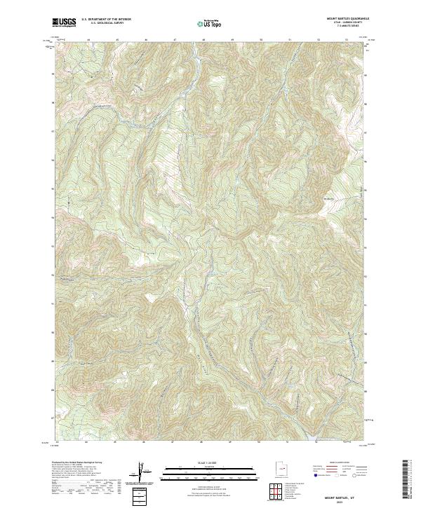
2023 Map of Mount Bartles
USGS Topo · Published 2023About this map
Mt Bartles stands as the high point of this high-elevation terrain in Carbon County, where a network of deeply incised drainages and steep ridges defines the landscape. The geography is characterized by the convergence of several major canyons, including Timothy Canyon, Bear Canyon, and Pace Canyon. Human activity is concentrated along established corridors like Pace Canyon Rd and the Cow Canyon Loop, providing access to isolated water sources such as Dancehall Spring and Hanging Rock Spring. The southern portion of the map transitions toward the Grassy Trail Reservoir, a vital catchment for the region. The map reveals the intricate natural plumbing of the West Ridge and South Ridge, illustrating how seasonal drainages like Graveyard Canyon and Little Spring Canyon feed the larger Whitmore Canyon system.
Find a feature on this map
26 named features on this map. Tap any name to fly to it.
Don’t see what you’re looking for? This feature index may not catch every label — zoom into the map to look around manually.
Map Details
Editions of this 2023 Mount Bartles Map
This is the sole edition of this map. No revisions or reprints were ever made.
Other maps of this area

1886 · Price River
USGS Topo · 1:250,000

1896 · Price River
USGS Topo · 1:250,000

1915 · Sunnyside
USGS Topo · 1:62,500

1915 · Wellington
USGS Topo · 1:62,500

1956 · Price
USGS Topo · 1:250,000

1960 · Price
USGS Topo · 1:250,000

1962 · Price
USGS Topo · 1:250,000

1968 · Wood Canyon
USGS Topo · 1:24,000
1968 · Currant Canyon
USGS Topo · 1:24,000
1969 · Minnie Maud Creek East
USGS Topo · 1:24,000