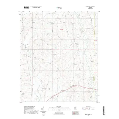
2020 Map of Mount Carmel
USGS Topo · Published 2020About this map
The Bowie River corridor defines the eastern edge of this landscape, where the border of Jefferson Davis and Covington Counties follows the river's winding path. This rural section of Mississippi is anchored by the historic communities of Mount Carmel and Clem, both situated along the local road network that connects several established family and community burial grounds. The land is drained by a network of creeks and branches including White Sand Cr and Jaybird Cr, which have shaped the settlement patterns visible here.
Find a feature on this map
101 named features on this map. Tap any name to fly to it.
Don’t see what you’re looking for? This feature index may not catch every label — zoom into the map to look around manually.
Map Details
Editions of this 2020 Mount Carmel Map
This is the sole edition of this map. No revisions or reprints were ever made.
Other maps of this area

1953 · Hattiesburg
USGS Topo · 1:250,000

1958 · Hattiesburg
USGS Topo · 1:250,000

1970 · Prentiss West
USGS Topo · 1:24,000

1970 · New Hebron
USGS Topo · 1:24,000

1970 · Prentiss East
USGS Topo · 1:24,000

1970 · Mount Carmel
USGS Topo · 1:24,000
1971 · Shivers
USGS Topo · 1:24,000
1971 · Mendenhall SE
USGS Topo · 1:24,000

1974 · Lone Star
USGS Topo · 1:24,000

1974 · Lake Mike Connor
USGS Topo · 1:24,000