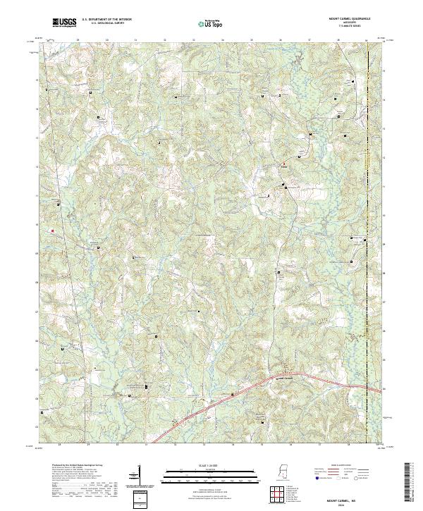
2024 Map of Mount Carmel
USGS Topo · Published 2024About this map
The Bowie River and its numerous tributaries, including White Sand Creek and Joybird Creek, define the landscape of this southern Mississippi territory along the Jefferson Davis and Covington County line. The settlement of Mount Carmel serves as a local focal point in the southern reaches, while Clem marks the central interior. This area is notably dense with family burial grounds and community landmarks, reflecting a deeply rooted rural genealogy.
Find a feature on this map
112 named features on this map. Tap any name to fly to it.
Don’t see what you’re looking for? This feature index may not catch every label — zoom into the map to look around manually.
Map Details
Editions of this 2024 Mount Carmel Map
This is the sole edition of this map. No revisions or reprints were ever made.
Other maps of this area

1953 · Hattiesburg
USGS Topo · 1:250,000

1958 · Hattiesburg
USGS Topo · 1:250,000

1970 · Prentiss West
USGS Topo · 1:24,000

1970 · New Hebron
USGS Topo · 1:24,000

1970 · Prentiss East
USGS Topo · 1:24,000

1970 · Mount Carmel
USGS Topo · 1:24,000
1971 · Shivers
USGS Topo · 1:24,000
1971 · Mendenhall SE
USGS Topo · 1:24,000

1974 · Lone Star
USGS Topo · 1:24,000

1974 · Lake Mike Connor
USGS Topo · 1:24,000