
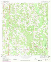
1970 Map of Mount Carmel
USGS Topo · Published 1972About this map
Mount Carmel and Clem anchor this rural landscape in Jefferson Davis County during the late 1960s, a period marked by the extensive footprint of the Gwinville Oil and Gas Field in the northwest. The terrain is deeply carved by drainage systems like White Sand Creek, Jaybird Creek, and Bowie Creek, which define the local topography. This survey provides significant genealogical value through its density of family-named landmarks and rural institutions, including the Clem Lookout Tower and numerous small country cemeteries such as Steward Cem and Magee Cem.
Find a feature on this map
33 named features on this map. Tap any name to fly to it.
Don’t see what you’re looking for? This feature index may not catch every label — zoom into the map to look around manually.
Map Details
Editions of this 1970 Mount Carmel Map
2 editions found
Other maps of this area

1953 · Hattiesburg
USGS Topo · 1:250,000

1958 · Hattiesburg
USGS Topo · 1:250,000

1970 · Prentiss West
USGS Topo · 1:24,000

1970 · New Hebron
USGS Topo · 1:24,000

1970 · Prentiss East
USGS Topo · 1:24,000
1971 · Shivers
USGS Topo · 1:24,000
1971 · Mendenhall SE
USGS Topo · 1:24,000

1974 · Lone Star
USGS Topo · 1:24,000

1974 · Lake Mike Connor
USGS Topo · 1:24,000
1975 · Magee South
USGS Topo · 1:24,000