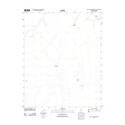
2011 Map of Mount Dellenbaugh
USGS Topo · Published 2011About this map
Mount Dellenbaugh rises as a prominent landmark in this high-elevation corner of Mohave County, where the topography transitions into the deep incisions of Twin Creek Canyon. The landscape is defined by its scarcity of permanent water, evidenced by the scattered reliance on Lower Spring, Mathis Spring, and Twin Spring. Towards the southern edge of the plateau, the terrain terminates at Twin Point and Suicide Point, offering a glimpse into the drainage patterns that feed the surrounding canyon systems. To the northeast, the relatively open expanse of Horse Valley provides a rare break in the broken ground. The inclusion of features like Suicide Tank and Suicide Spring highlights the critical importance of specific water sources for livestock and local travel in this arid Arizona environment during the early twenty-first century.
Find a feature on this map
10 named features on this map. Tap any name to fly to it.
Don’t see what you’re looking for? This feature index may not catch every label — zoom into the map to look around manually.
Map Details
Editions of this 2011 Mount Dellenbaugh Map
This is the sole edition of this map. No revisions or reprints were ever made.
Other maps of this area

1886 · Diamond Creek
USGS Topo · 1:250,000

1886 · Mt. Trumbull
USGS Topo · 1:250,000

1892 · Diamond Creek
USGS Topo · 1:250,000

1892 · Mt. Trumbull
USGS Topo · 1:250,000

1948 · Williams
USGS Topo · 1:250,000

1953 · Grand Canyon
USGS Topo · 1:250,000

1954 · Williams
USGS Topo · 1:250,000

1956 · Williams
USGS Topo · 1:250,000

1957 · Grand Canyon
USGS Topo · 1:250,000

1958 · Grand Canyon
USGS Topo · 1:250,000