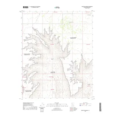
2018 Map of Mount Dellenbaugh
USGS Topo · Published 2018About this map
Mt Dellenbaugh rises as a prominent landmark in this northern Mohave County landscape, where the high plateaus meet deep drainage systems. The survey highlights the intersection of two major federal protected areas, showing the boundary where the Lake Mead National Recreation Area meets Grand Canyon National Park. The terrain is defined by dramatic elevation changes and named escarpments such as Suicide Point and Twin Point. Water management in this arid environment is evidenced by features like Suicide Tank and various named seeps including Mathis Spring and Twin Spring. These isolated water sources and the network of canyons, such as Twin Creek Canyon and Green Spring Canyon, illustrate the traditional rangeland geography of the Arizona Strip.
Find a feature on this map
23 named features on this map. Tap any name to fly to it.
Don’t see what you’re looking for? This feature index may not catch every label — zoom into the map to look around manually.
Map Details
Editions of this 2018 Mount Dellenbaugh Map
This is the sole edition of this map. No revisions or reprints were ever made.
Other maps of this area

1886 · Diamond Creek
USGS Topo · 1:250,000

1886 · Mt. Trumbull
USGS Topo · 1:250,000

1892 · Diamond Creek
USGS Topo · 1:250,000

1892 · Mt. Trumbull
USGS Topo · 1:250,000

1948 · Williams
USGS Topo · 1:250,000

1953 · Grand Canyon
USGS Topo · 1:250,000

1954 · Williams
USGS Topo · 1:250,000

1956 · Williams
USGS Topo · 1:250,000

1957 · Grand Canyon
USGS Topo · 1:250,000

1958 · Grand Canyon
USGS Topo · 1:250,000