
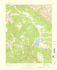
1938 Map of Mount Elbert
USGS Topo · Published 1944About this map
Mt Elbert and Mt Massive, two of the highest peaks in the Rockies, dominate this 1930s landscape. The survey captures a high-altitude economy transitioning from the peak of 19th-century extraction to mid-20th-century conservation and recreation. Mining heritage is evident in the numerous gulches like Iowa Gulch and Empire Gulch, alongside the Columbine Mine. Meanwhile, the presence of the US Fish Hatchery and the Mt Massive Trout Club signals an era of managed natural resources.
Find a feature on this map
89 named features on this map. Tap any name to fly to it.
Don’t see what you’re looking for? This feature index may not catch every label — zoom into the map to look around manually.
Map Details
Editions of this 1938 Mount Elbert Map
This is the sole edition of this map. No revisions or reprints were ever made.
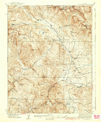
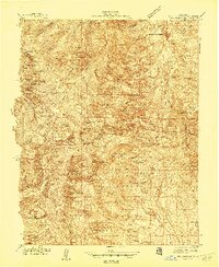
Other maps of this area

1889 · Leadville
USGS Topo · 1:125,000

1891 · Leadville
USGS Topo · 1:125,000

1909 · Mount Jackson
USGS Topo · 1:125,000

1911 · Mount Jackson
USGS Topo · 1:125,000

1934 · Climax
USGS Topo · 1:48,000
1934 · Taylor Park
USGS Topo · 1:62,500
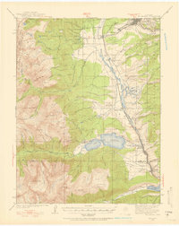
1935 · Mount Elbert
USGS Topo · 1:62,500
1937 · Taylor Park
USGS Topo · 1:62,500
1938 · Mt. Lincoln
USGS Topo · 1:48,000

1939 · Mount Elbert
USGS Topo · 1:62,500