
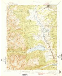
1939 Map of Mount Elbert
USGS Topo · Published 1939About this map
Leadville and its surrounding mining districts dominate this late 1930s survey, illustrating the complex infrastructure of the Upper Arkansas River valley. The map reveals a landscape defined by industry and water management, featuring the Denver and Rio Grande Western railroad winding through settlements like Malta, Snowden, and Kobe. The massive Twin Lakes Reservoir serves as a central hydrological landmark, while the Carlton Tunnel and the Columbine Mine underscore the region's long-standing reliance on resource extraction.
Find a feature on this map
79 named features on this map. Tap any name to fly to it.
Don’t see what you’re looking for? This feature index may not catch every label — zoom into the map to look around manually.
Map Details
Editions of this 1939 Mount Elbert Map
2 editions found
Other maps of this area

1889 · Leadville
USGS Topo · 1:125,000

1891 · Leadville
USGS Topo · 1:125,000

1909 · Mount Jackson
USGS Topo · 1:125,000

1911 · Mount Jackson
USGS Topo · 1:125,000

1934 · Climax
USGS Topo · 1:48,000

1934 · Taylor Park
USGS Topo · 1:62,500

1935 · Mount Elbert
USGS Topo · 1:62,500

1937 · Taylor Park
USGS Topo · 1:62,500

1938 · Mt. Lincoln
USGS Topo · 1:48,000

1938 · Mount Elbert
USGS Topo · 1:62,500