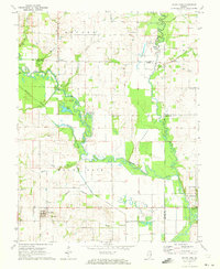
1971 Map of Mount Erie
USGS Topo · Published 1973About this map
Mount Erie occupies a prominent position in this rural Illinois landscape, situated just south of the complex winding course of the Little Wabash River. The river's influence is evident in the dense network of wetlands and backwaters, such as Goose Pond, Old River Lake, and Clear Pond, which dominate the central portion of the map. This early 1970s survey illustrates a region defined by agricultural land and small crossroads settlements like Wynoose and Bennington, linked by a system of country roads and drainage works including the West Side Diversion Ditch.
Find a feature on this map
41 named features on this map. Tap any name to fly to it.
Don’t see what you’re looking for? This feature index may not catch every label — zoom into the map to look around manually.
Map Details
Editions of this 1971 Mount Erie Map
2 editions found
Other maps of this area

1943 · Albion
USGS Topo · 1:62,500

1946 · Albion
USGS Topo · 1:62,500

1948 · Fairfield
USGS Topo · 1:62,500

1948 · Flora
USGS Topo · 1:62,500

1949 · Olney
USGS Topo · 1:62,500

1949 · Flora
USGS Topo · 1:62,500

1958 · Belleville
USGS Topo · 1:250,000

1962 · Belleville
USGS Topo · 1:250,000

1970 · Clay City
USGS Topo · 1:24,000

1970 · Enterprise
USGS Topo · 1:24,000