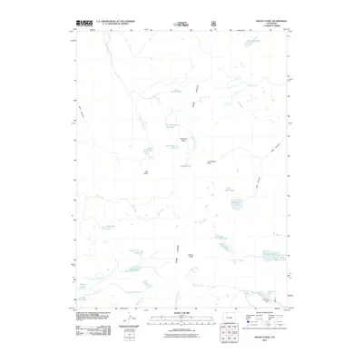
2011 Map of Mount Ethel
USGS Topo · Published 2011About this map
The high crests of the Park Range dominate this 2011 survey, centered on the prominent summit of Mount Ethel. This alpine landscape is defined by its complex hydrography, where numerous high-altitude basins hold glacial waters like Wolverine Lake, Ptarmigan Lake, and Lake of the Crags. The eastern slopes drain through deep incisions such as Red Canyon, while the western reaches feed the South Fork Elk River.
Find a feature on this map
37 named features on this map. Tap any name to fly to it.
Don’t see what you’re looking for? This feature index may not catch every label — zoom into the map to look around manually.
Map Details
Editions of this 2011 Mount Ethel Map
This is the sole edition of this map. No revisions or reprints were ever made.
Other maps of this area

1911 · Hahns Peak
USGS Topo · 1:125,000

1913 · Hahns Peak
USGS Topo · 1:125,000

1954 · Craig
USGS Topo · 1:250,000

1955 · Buffalo Pass
USGS Topo · 1:24,000

1955 · Mount Zirkel
USGS Topo · 1:24,000

1955 · Pitchpine Mountain
USGS Topo · 1:24,000

1955 · Mount Ethel
USGS Topo · 1:24,000

1955 · Teal Lake
USGS Topo · 1:24,000

1955 · Mount Ethel
USGS Topo · 1:62,500
1956 · Boettcher Lake
USGS Topo · 1:24,000