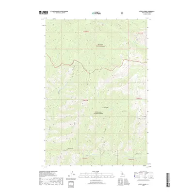
2020 Map of Mount George
USGS Topo · Published 2020About this map
Bitterroot National Forest and Nez Perce National Forest meet in this high-altitude drainage of Idaho County. The terrain is structured by prominent ridgelines and summits, including the notable Mount George and Bad Luck Mtn to the south. A central topographic feature, the Forest Divide, runs through the northern half of the quadrangle, separating the various forks and creeks that define the watershed. Waterways such as Gardiner Fork and Bad Luck Creek carve through the landscape, feeding into larger systems like Whitecap Creek. The map documents a wilderness landscape defined by its complex drainage networks and high points like Cub Point and Cedar Saddle. This survey reflects the modern management of these federal forest lands, showing the established naming conventions for the remote peaks and creek forks that have historically served as landmarks for backcountry travel and resource management in the region.
Find a feature on this map
28 named features on this map. Tap any name to fly to it.
Don’t see what you’re looking for? This feature index may not catch every label — zoom into the map to look around manually.
Map Details
Editions of this 2020 Mount George Map
This is the sole edition of this map. No revisions or reprints were ever made.
Other maps of this area

1911 · Lolo
USGS Topo · 1:250,000

1913 · Lolo
USGS Topo · 1:250,000

1956 · Elk City
USGS Topo · 1:250,000

1956 · Hamilton
USGS Topo · 1:250,000

1959 · Hamilton
USGS Topo · 1:250,000

1960 · Elk City
USGS Topo · 1:250,000

1960 · Hamilton
USGS Topo · 1:250,000

1964 · Hamilton
USGS Topo · 1:250,000

1966 · Watchtower Peak
USGS Topo · 1:24,000

1966 · Spot Mountain
USGS Topo · 1:24,000