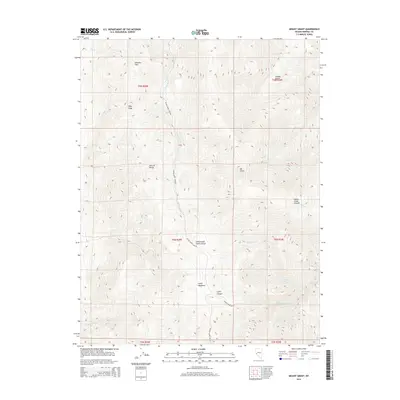
2014 Map of Mount Grant
USGS Topo · Published 2014About this map
Mt Grant and the high elevations of the Wassuk Range dominate this Nevada landscape in Mineral County. This modern survey illustrates a rugged vertical environment where drainage systems like Cottonwood Cr, Dutch Cr, and Squaw Cr descend from steep summits into deep incisions such as Cottonwood Canyon and House Creek Canyon. The map identifies rare high-altitude grazing or resting areas like Lapon Meadows, which stands in contrast to the surrounding sharp ridges and peaks like Pike Peak. Human footprints are sparse in this high-desert terrain, marked primarily by the Ninemile Ranch and the locality of Lucky Boy. Water sources essential for life in the Great Basin are documented at sites like Box Spring, providing critical context for understanding historic land use and movement through natural corridors such as Wheeler Pass.
Find a feature on this map
30 named features on this map. Tap any name to fly to it.
Don’t see what you’re looking for? This feature index may not catch every label — zoom into the map to look around manually.
Map Details
Editions of this 2014 Mount Grant Map
This is the sole edition of this map. No revisions or reprints were ever made.
Other maps of this area

1909 · Hawthorne
USGS Topo · 1:250,000

1911 · Hawthorne
USGS Topo · 1:250,000

1915 · Hawthorne
USGS Topo · 1:250,000

1948 · Walker Lake
USGS Topo · 1:250,000

1955 · Powell Mtn
USGS Topo · 1:62,500

1955 · Hawthorne
USGS Topo · 1:62,500

1956 · Mt. Grant
USGS Topo · 1:62,500

1956 · Aurora
USGS Topo · 1:62,500

1957 · Walker Lake
USGS Topo · 1:250,000

1962 · Walker Lake
USGS Topo · 1:250,000