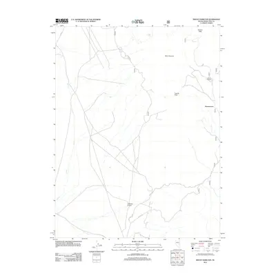
2012 Map of Mount Hamilton
USGS Topo · Published 2012About this map
Shermantown sits on the eastern edge of this high-elevation landscape in White Pine County, where steep terrain and isolated water sources define the geography. The high points of Mount Hamilton and Pogonip Ridge dominate the central topography, while Babylon Ridge marks the northern boundary. These peaks are separated by deep drainages such as Rocco Canyon and the dramatic Cathedral Canyon to the south. Small, critical water sources like Monte Cristo Spring and Hoppe Spring appear as vital landmarks in an otherwise arid environment. The road network, including the White Pine Co Rd and NFD 401 Rd, suggests a landscape managed for forest access and rural connectivity through the Great Basin's characteristically vertical relief.
Find a feature on this map
11 named features on this map. Tap any name to fly to it.
Don’t see what you’re looking for? This feature index may not catch every label — zoom into the map to look around manually.
Map Details
Editions of this 2012 Mount Hamilton Map
This is the sole edition of this map. No revisions or reprints were ever made.
Other maps of this area

1949 · Treasure Hill
USGS Topo · 1:62,500

1950 · Treasure Hill
USGS Topo · 1:62,500

1951 · Green Springs
USGS Topo · 1:62,500

1951 · Illipah
USGS Topo · 1:62,500

1951 · Pancake Summit
USGS Topo · 1:62,500

1956 · Ely
USGS Topo · 1:250,000

1959 · Ely
USGS Topo · 1:250,000

1963 · Ely
USGS Topo · 1:250,000

1979 · Mt. Hamilton
USGS Topo · 1:100,000

1990 · Pancake Summit SW
USGS Topo · 1:24,000