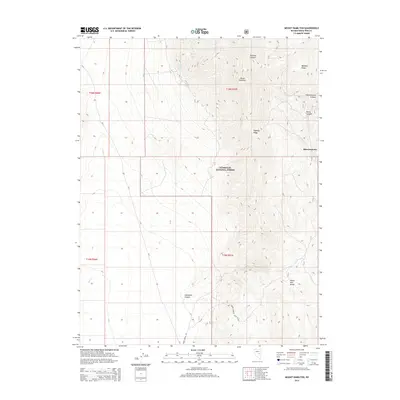
2014 Map of Mount Hamilton
USGS Topo · Published 2014About this map
Shermantown sits at the high-elevation intersection of canyon drainages in the White Pine Range, where the geography is defined by the steep relief of the Humboldt National Forest. This 2014 survey details a landscape of extreme verticality, dominated by the massif of Mount Hamilton and the long, serrated spine of Pogonip Ridge. The map illustrates the specialized transport network required for this high-desert environment, showing routes like Green Spring Rd and Natl Forest Develop Road 401 Rd as they navigate the deep cuts of McEllen Canyon and Shermantown Canyon. Water sources are precious and specifically marked, including Monte Cristo Spring and Hoppe Spring, which historically supported the isolated mining and ranching outposts of this Nevada interior. The naming of features like Babylon Ridge and Rocco Canyon suggests the localized history of prospectors and settlers who worked these limestone slopes.
Find a feature on this map
22 named features on this map. Tap any name to fly to it.
Don’t see what you’re looking for? This feature index may not catch every label — zoom into the map to look around manually.
Map Details
Editions of this 2014 Mount Hamilton Map
This is the sole edition of this map. No revisions or reprints were ever made.
Other maps of this area

1949 · Treasure Hill
USGS Topo · 1:62,500

1950 · Treasure Hill
USGS Topo · 1:62,500

1951 · Green Springs
USGS Topo · 1:62,500

1951 · Illipah
USGS Topo · 1:62,500

1951 · Pancake Summit
USGS Topo · 1:62,500

1956 · Ely
USGS Topo · 1:250,000

1959 · Ely
USGS Topo · 1:250,000

1963 · Ely
USGS Topo · 1:250,000

1979 · Mt. Hamilton
USGS Topo · 1:100,000

1990 · Pancake Summit SW
USGS Topo · 1:24,000