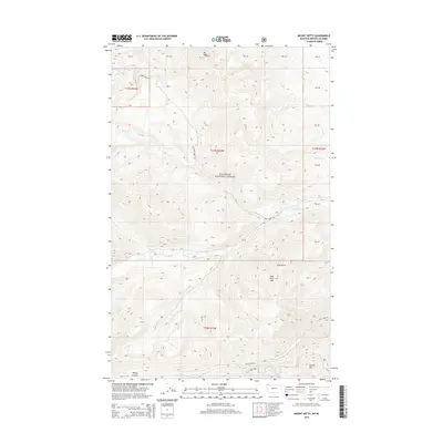
2014 Map of Mount Hefty
USGS Topo · Published 2014About this map
Flathead National Forest defines the character of this northern Montana landscape, where the peaks of the Whitefish Range meet the Canadian border. Dominating the high ground are Mt Hefty and Cleft Rock Mtn, which overlook a complex network of drainage basins including Yakinikak Cr and Thoma Cr. The map shows a terrain shaped by steep elevation changes, with Wedge Canyon and the prominent Cleft Rock serving as significant natural landmarks for navigators and foresters alike.
Find a feature on this map
23 named features on this map. Tap any name to fly to it.
Don’t see what you’re looking for? This feature index may not catch every label — zoom into the map to look around manually.
Map Details
Editions of this 2014 Mount Hefty Map
This is the sole edition of this map. No revisions or reprints were ever made.
Other maps of this area

1906 · Kintla Lakes
USGS Topo · 1:125,000

1913 · Stryker
USGS Topo · 1:125,000

1916 · Stryker
USGS Topo · 1:125,000

1938 · Kintla Lakes
USGS Topo · 1:125,000

1957 · Kalispell
USGS Topo · 1:250,000

1960 · Kalispell
USGS Topo · 1:250,000

1961 · Kalispell
USGS Topo · 1:250,000

1966 · Red Meadow Lake
USGS Topo · 1:24,000

1966 · Mount Hefty
USGS Topo · 1:24,000
1966 · Mount Thompson-Seton
USGS Topo · 1:24,000