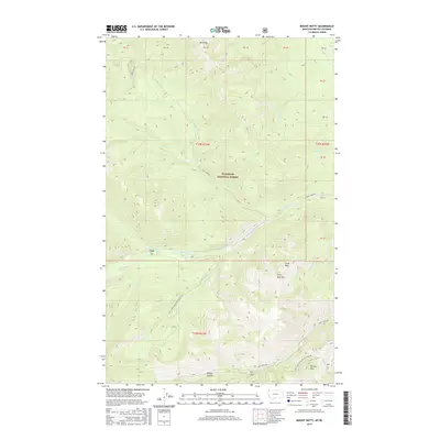
2017 Map of Mount Hefty
USGS Topo · Published 2017About this map
Flathead National Forest defines this high-elevation landscape in the late twenty-tens, where the peaks of Mt Hefty and Hornet Mtn overlook a dense network of drainage creeks and forest service infrastructure. This corner of Northwest Montana is characterized by a complex hydrography, with Yakinikak Creek and Tepee Creek cutting deep through the terrain. The presence of Wedge Canyon and several named peaks like Cleft Rock Mountain indicate a high-relief environment managed for conservation and timber.
Find a feature on this map
30 named features on this map. Tap any name to fly to it.
Don’t see what you’re looking for? This feature index may not catch every label — zoom into the map to look around manually.
Map Details
Editions of this 2017 Mount Hefty Map
This is the sole edition of this map. No revisions or reprints were ever made.
Other maps of this area

1906 · Kintla Lakes
USGS Topo · 1:125,000

1913 · Stryker
USGS Topo · 1:125,000

1916 · Stryker
USGS Topo · 1:125,000

1938 · Kintla Lakes
USGS Topo · 1:125,000

1957 · Kalispell
USGS Topo · 1:250,000

1960 · Kalispell
USGS Topo · 1:250,000

1961 · Kalispell
USGS Topo · 1:250,000

1966 · Red Meadow Lake
USGS Topo · 1:24,000

1966 · Mount Hefty
USGS Topo · 1:24,000
1966 · Mount Thompson-Seton
USGS Topo · 1:24,000