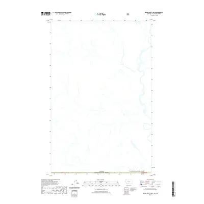
2020 Map of Mount Hefty OE N
USGS Topo · Published 2020About this map
The international border between the Canada United States of America and the northern reaches of Montana defines the upper limits of this 2020 topographic study. Dominated by the protected landscape of the Flathead National Forest, the region is characterized by a dense network of mountain drainage systems and high-elevation terrain. This survey provides a modern digital representation of the borderlands, where precise surveying of T37n R22w and specific cadastral markers like PB 41 are critical for land management. The absence of developed roads or named settlements underscores the wilderness character of this specific sector, located at the very edge of the Flathead basin.
Find a feature on this map
4 named features on this map. Tap any name to fly to it.
Don’t see what you’re looking for? This feature index may not catch every label — zoom into the map to look around manually.
Map Details
Editions of this 2020 Mount Hefty OE N Map
This is the sole edition of this map. No revisions or reprints were ever made.
Other maps of this area

1906 · Kintla Lakes
USGS Topo · 1:125,000

1913 · Stryker
USGS Topo · 1:125,000

1916 · Stryker
USGS Topo · 1:125,000

1938 · Kintla Lakes
USGS Topo · 1:125,000

1957 · Kalispell
USGS Topo · 1:250,000

1960 · Kalispell
USGS Topo · 1:250,000

1961 · Kalispell
USGS Topo · 1:250,000

1966 · Mount Hefty
USGS Topo · 1:24,000
1966 · Tuchuck Mountain
USGS Topo · 1:24,000
1966 · Trailcreek
USGS Topo · 1:24,000