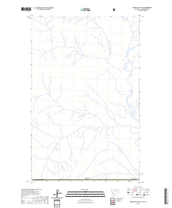
2024 Map of Mount Hefty OE N
USGS Topo · Published 2024About this map
The international boundary of Canada forms the northern terminus of this landscape in Flathead Co, Montana. This high-altitude drainage basin is defined by the headwaters of numerous unnamed mountain streams that flow south and east across the border region. The map reveals the intricate hydrography of the northern Rocky Mountains at the very edge of the United States, providing a detailed view of the natural watercourses that shape the terrain before they consolidate into larger river systems. While modern in its 2024 publication, the lack of named roads or settlements emphasizes the wild, undeveloped character of this specific portion of the border, where the primary human-defined feature is the political boundary between nations.
Find a feature on this map
3 named features on this map. Tap any name to fly to it.
Don’t see what you’re looking for? This feature index may not catch every label — zoom into the map to look around manually.
Map Details
Editions of this 2024 Mount Hefty OE N Map
This is the sole edition of this map. No revisions or reprints were ever made.
Other maps of this area

1906 · Kintla Lakes
USGS Topo · 1:125,000

1913 · Stryker
USGS Topo · 1:125,000

1916 · Stryker
USGS Topo · 1:125,000

1938 · Kintla Lakes
USGS Topo · 1:125,000

1957 · Kalispell
USGS Topo · 1:250,000

1960 · Kalispell
USGS Topo · 1:250,000

1961 · Kalispell
USGS Topo · 1:250,000

1966 · Mount Hefty
USGS Topo · 1:24,000
1966 · Tuchuck Mountain
USGS Topo · 1:24,000
1966 · Trailcreek
USGS Topo · 1:24,000